Check the Air Quality in your area with Google Maps
With the advent of modern technology, exhaust from factories and vehicles are a constant source of air pollution. Planting and other campaigns are being made to reduce air pollution.
In addition to devices that measure pollution in your area, there are also phone applications. According to the June 8 Blog Post, Google has added a system to measure air quality in Google Maps and the weather forecasts. The Air Quality Index (AQI), which measures air pollution, is set from zero to 400+. The lower the number, the lower the air pollution will be. To view the rating, click on the Layer icon in the upper right corner of the Google Maps app and select Air Quality in Map Details.
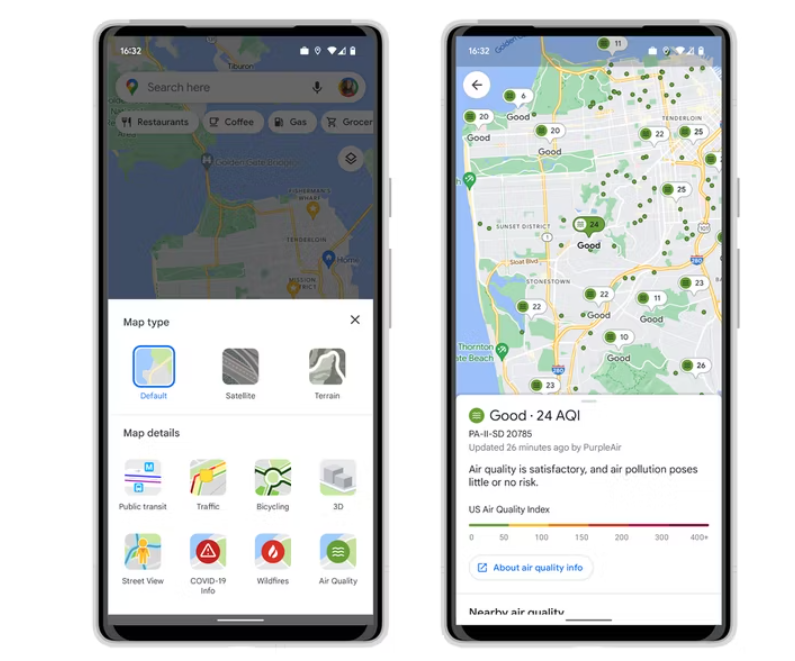
Photo Source Google
Google Maps’s air pollution system uses data from government agencies such as the Environmental Protection Agency (EPA). Users can also check features such as Wildfire and COVID-19 Info in addition to the Air Quality feature.