The non-widely use of GPS in local country
We all knew that, GPS (Global Positioning System) is one of the locations describing system. The system includes all of the today’s smart phones. GPS is based on a satellite system, so it does not require internet connection. Navigation system, Latitude and Longitude describing system for calculation of survey can be used with GPS. The applications which have been arrived in Myanmar such as Ueber and Grab, are serviced by using GPS. Watching the route to travel, hotels and restaurants can be found by using GPS before going to the new place.
GPS is the system which is very effective in human beings. But, the use of GPS Navigation is still weak in our local country. Because of non-wide use of GPS, the problems often evolve such as the taxi driver lost their routes and continuously call, and the delivery man also lost their routes and continuously call even we have been given the accurate address to send our packages. If the taxi driver uses GPS in sending and getting passengers, he/she can give the best service and can create an accurate and fast route.
By using a GPS Navigation system in delivery services, the packages route can be created accurately without delivery delay and it cannot be required to call continuously to customers. We will describe some of the free GPS Navigation Map Applications which can be downloaded easily in our smart phones.
Google Maps
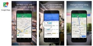
Image Source : http://www.techmanik.com/best-navigation-app-for-android/
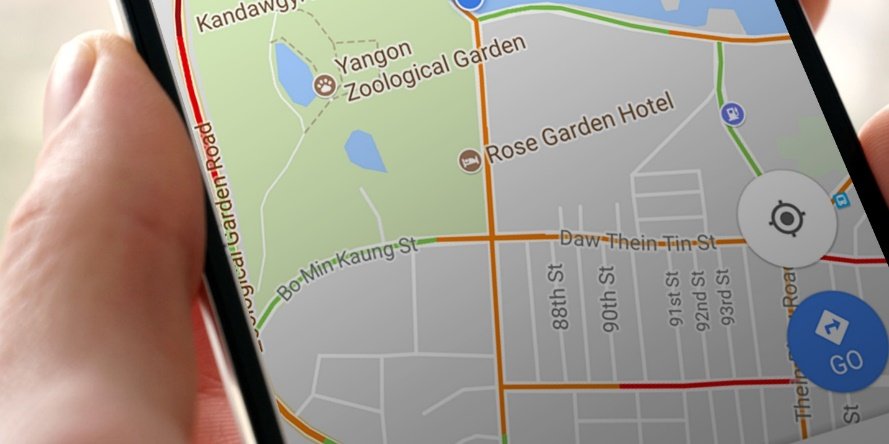
It is a free map application which is developed from ‘Google’, the technology company. It is the most commonly used Map Application. In this application, not only the map location, but also the buildings, pagodas and restaurants in our located place can be found. It also includes the name of the streets which are accurately described. It includes not only Traffic condition and transportation system, but also Turn-By-Turn Navigation system. So, it can be watched the map with pictures. It can also be found in the location of the place where we want to travel.
At the start, it requires internet connection and can also be downloaded the location of that place for offline maps.
Google Earth
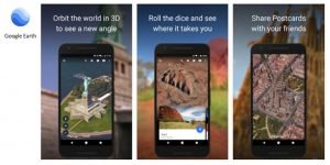
Image Source : https://play.google.com/store/apps/details?id=com.google.earth&hl=en
The brother of Google Maps or Google Earth Application especially showed the satellite pictures and the geographic coordinate graphs.
And also showed the buildings with 3D.
The difference between Google Maps and Google Earth is that Google Earth cannot do Navigation.
It’s Engineers and Surveyors especially used and can integrate the AutoCAD Pictures.
Open Street Map
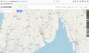 Image Source : https://www.openstreetmap.org
The OpenStreetMap.org Web site is a Map Open source for Map Application inventors. On this website, the sign of street names and building names can be seen with accurate details. After opening accounts, map data can be copied which can then be used in other applications or websites. Like Google Maps, it can do Navigation and can watch by transforming to Bicycle Map and Transportation Map.
Map.me
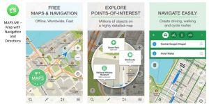
Image Source : http://www.techmanik.com/best-navigation-app-for-android/
Another application which can be used with free and fast.
It includes the functions like Google Maps and can also use by downloading a free offline map.
It also includes the features that can be added the new locations or new data by the users.
 Image Source : http://www.mysatnav.ie/garmin
Among the various GPS Navigation Applications, it has been described some widely used applications. Most features included in GPS Navigation Application are same and functions are not really different. Features can be researched and can be used effectively. The GPS system which can be used in cars have also been arriving in Myanmar. Nowadays, it can be connected the GPS with smart phone holder’s email and can be found the lost phone with this locator finding system. It has been presented that, GPS technology is one of the effective technology for all human beings.
Sai Moon